|
Back to 'Analysis' Main Page
|

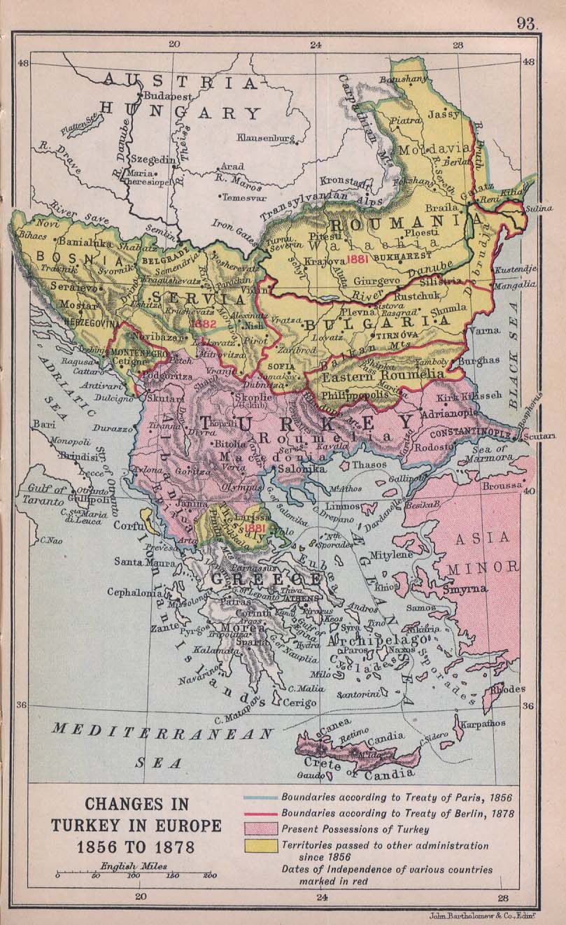
Changes in Turkey in Europe 1856 to 1878.
From "Literary and Historical Atlas of Europe", by J.G. Bartholomew, 1912. http://www.lib.utexas.edu/maps/historical/ balkans_1912.jpg |
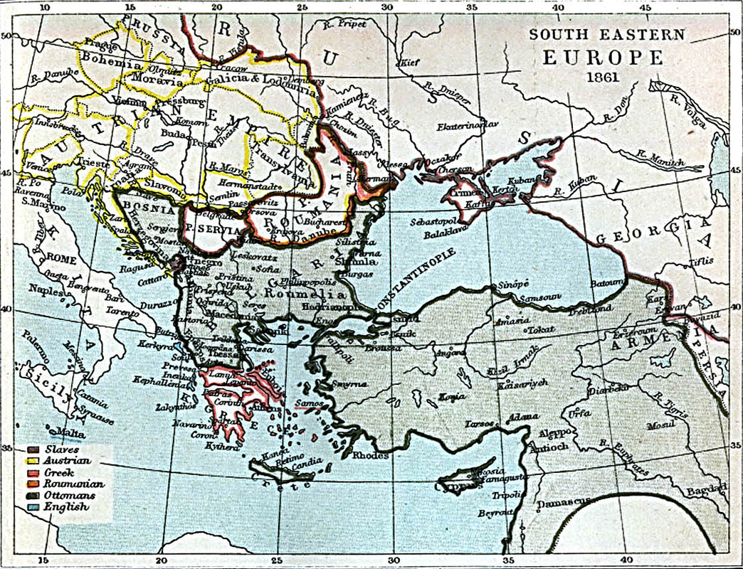
South Eastern Europe
|
Bulgaria after Conference of Constantinople 1876-1877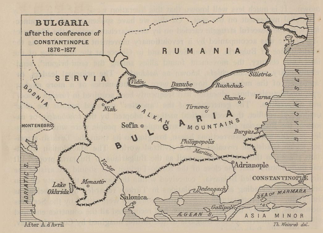
Bulgaria after Conference of Constantinople 1876-1877. From "Report of the International Commission To Inquire into the Causes and Conduct of the Balkan Wars" 1914.
http://www.lib.utexas.edu/maps/ historical/balkan_boundaries_1914.jpg |
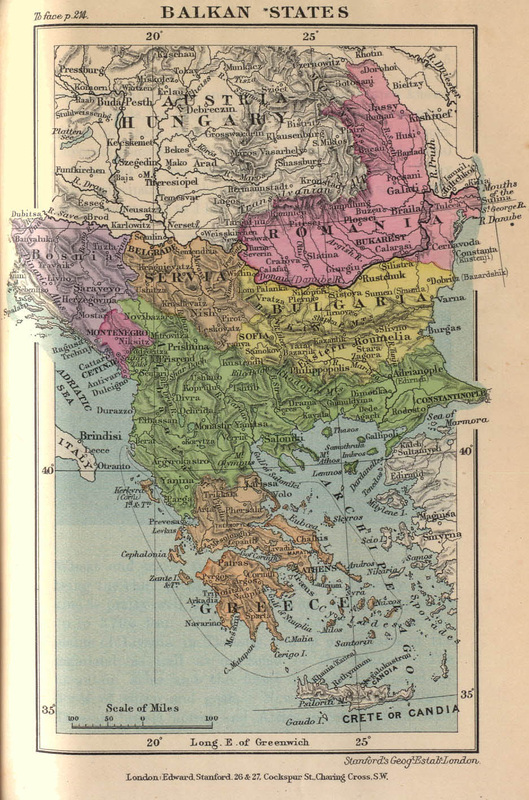
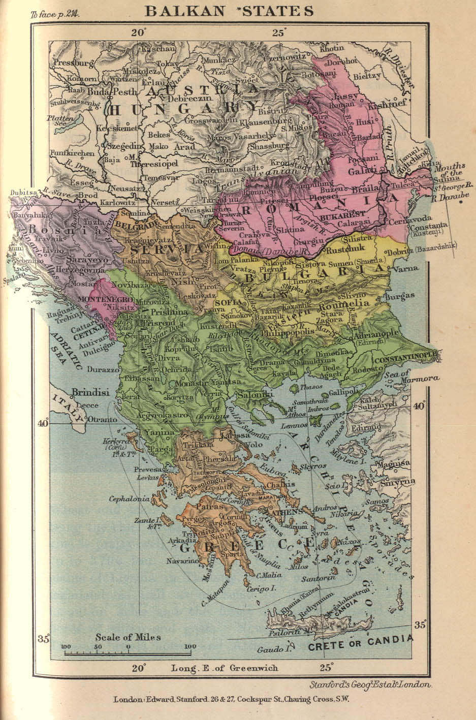
Balkan States
|
MAPS OF MODERN STRATEGIC AND TERRITORIAL ASPIRATIONS (Balkan Wars)
These maps show the territorial aspirations amongst the main players in the Balkans - Greeks, Serbians, Bulgarians and Romanians - prior to the collapse of the Ottoman Empire (Balkan Wars 1912-1913).
Map: International Commission into the Causes of the Balkan Wars
Map from "Report of the International Commission To Inquire into the Causes and Conduct of the Balkan Wars" 1914." There was hardly any part of the territory of Turkey in Europe which was not claimed by at least two competitors."-- Report of
the International Commission To Inquire into the Causes and Conduct of the Balkan Wars, Carnegie Endowment for International Peace, 1914, p.38. |
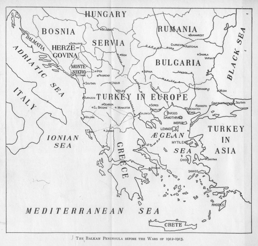
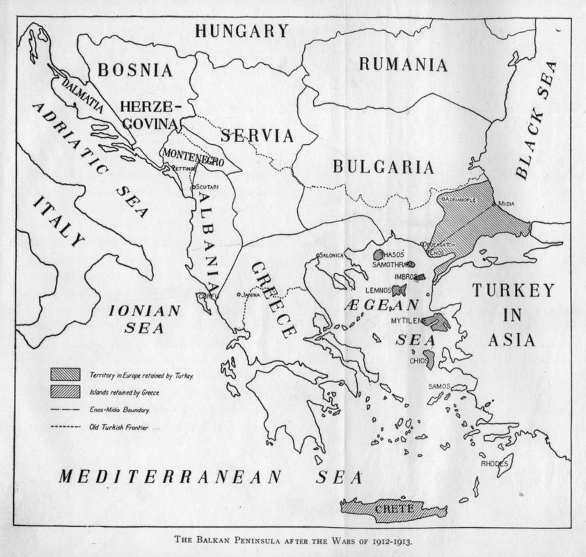
Map of the Balkan Peninsula before the Balkan Wars of
|
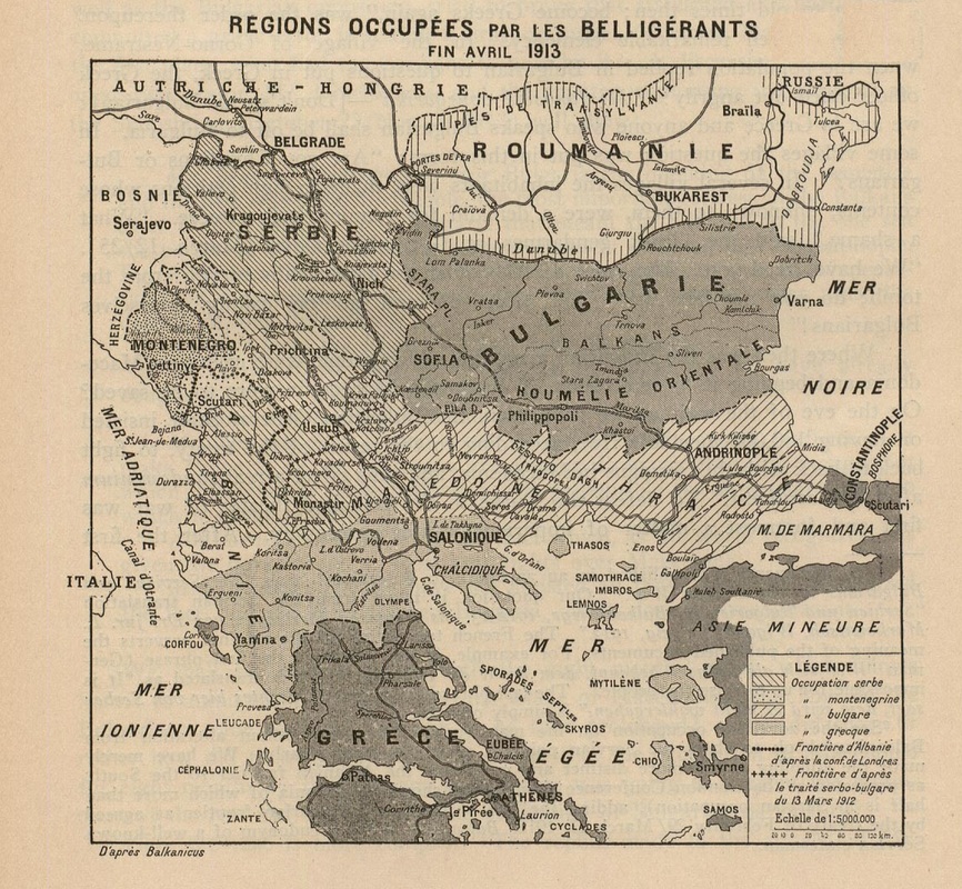
Map Showing Turkey's Territorial Losses - End of the First Balkan War 1912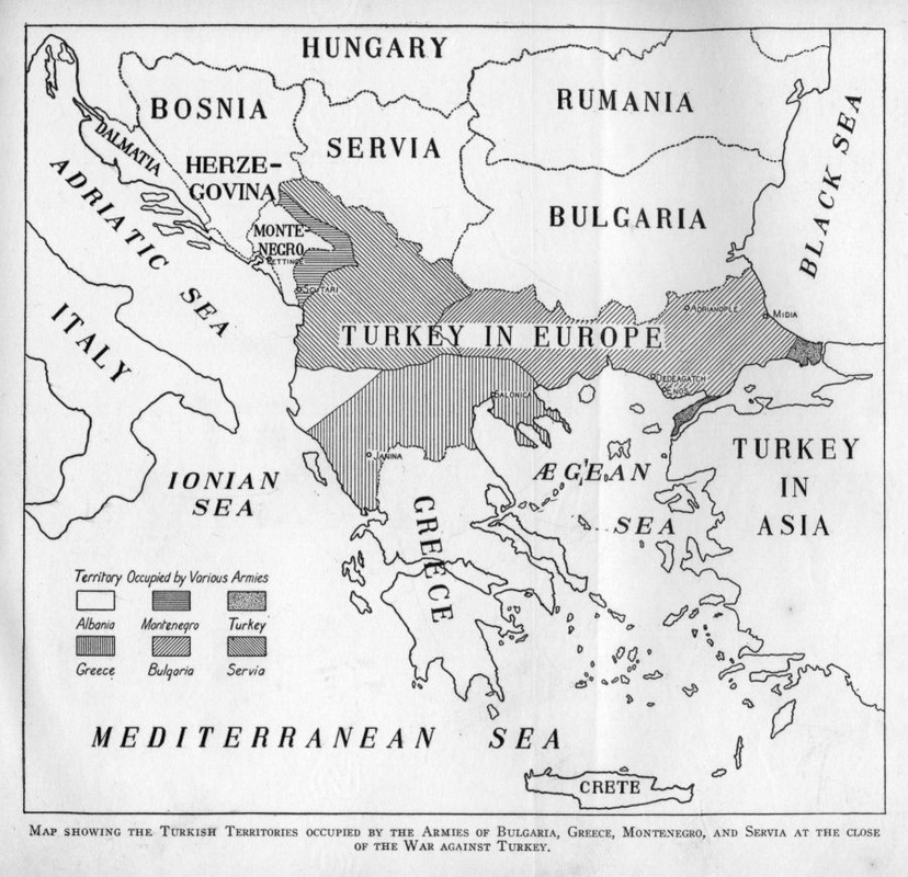
Map showing the Turkish Territories occupied by the Armies of Bulgaria, Greece, Montenegro, and Servia at the close of the War against Turkey.
http://www.gutenberg.org/files/ 36192/36192-h/36192-h.htm |
|
|
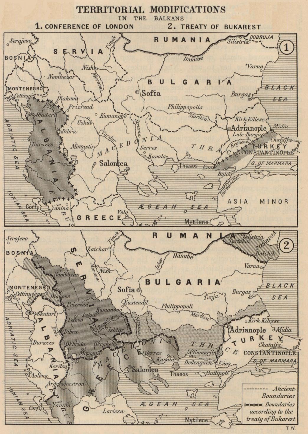
Territorial Modifications in the Balkans - Conference of London and Treaty of Bucharest (May/Aug 1913)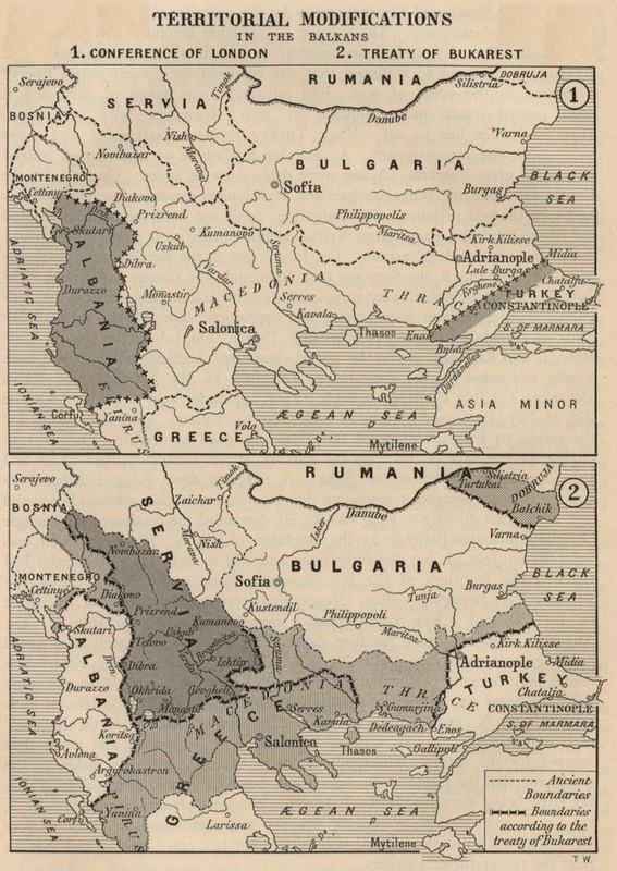
Territorial Modifications in the Balkans - Conference of London (May 1913) and Treaty of Bucharest (August 1913). Map from "Report of the International Commission To Inquire into the Causes and Conduct of the Balkan Wars" 1914. "The Treaty of London (30 May 1913) ceded to the Balkan allies all territories 'west of a line drawn from Enos on the Aegean Sea to Midia on the Black Sea, with the exception of Albania. It was not only a defeat of the military forces of the Turkish empire, but a defeat of the Austrian dream of Drang nach Osten. ...Austria-Hungary and Italy, rather than see Albania partitioned between Slav states on the north and Greece on the south, had succeeded in blocking Serbian access to the Adriatic by proposing the creation of an autonomous Albania."--quote from: Great Britain. Naval Intelligence Division, Geographical Handbook Series: Jugoslavia, Volume II, 1944, p. 114.
http://www.lib.utexas.edu/maps/historical/ balkan_modifications_1914.jpg |
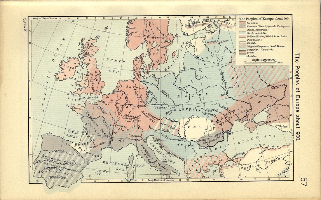
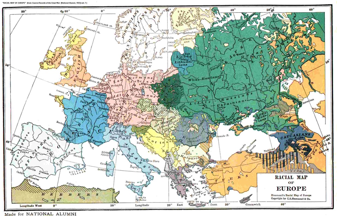
DEMOGRAPHY
Demographic maps of Europe throughout various eras of history. Skopje insists that they can not negotiate on the name issue for the country because it represents a "direct continuity" of their ethnicity from the ancient times (i.e. the time of the ancient Macedonians) and the supposed Macedonian state which they say always existed as a separate political entity. However, modern demographic maps prior to 1900's never included such a "Macedonian ethnicity" or the existence of a "Macedonian state" which points to the fact that the term "Macedonian" was, in fact, a modern construct. This modern construct was first cultivated in the late 1880's by Bulgarian Krste Misirkov in his book "On Macedonian Matters" in a bid to push for Bulgaria's control of the geographic region of Macedonia. His position was that the Bulgarians in the geographic region should be a distinct group of people in the Bulgarian group of family in order to secure Bulgaria's control in the region. This was done due to Serbia's claim in the territory. In 1924, Misirkov stated: "Whether we call ourselves Bulgarians or Macedonians, we always identify as a distinct and unified people with Bulgarian national awareness, completely different from Serbs." (Bulgarian Historian, Krste Misirkov Vestnik News, May 11, 1924)
Eventually, Misirkov went back and forth on his new ethnic designation - Macedonian - and stopped promoting the idea of a distinct Macedonian Bulgarian nation altogether by the end of World War I at which time the name issue experiment was put to rest.
Decades later, the Macedonian name issue was brought back to life in Yugoslavia in 1944 as maps of Yugoslavia prior to this date attest to the non-existence of such an ethnic group in Yugoslavia prior to 1944. Also, as far as ancient continuity is concerned, it would be impossible for an ancient Greek tribe - the ancient Macedonians - to be represented today by an unrelated Slavic nation in a modern state that falls outside of the bona-fide territories of ancient Macedonia. As can be seen in maps of Greece the claims put forth by Skopje are steeped in the propaganda put forth by the Comintern and Tito's Yugoslavia of the 1940's who created the question in a bid to annex Greece's province of Macedonian during the Greek Civil War.
The point of these maps below is to illustrate that "Macedonians" were never listed as a distinct ethnic group in Europe prior to the Bulgarian propaganda wars of the late 1880's to the early 1900's in the geographic region of Macedonia that was initiated in the pursuit of territorial aspirations in the region. Bulgaria's territorial aspirations came to an end with the signing of the Treaty of Bucharest in 1913. However, in world war II, seeing an opportunity to take control of the much coveted region, Bulgaria sided with the Axis and went on to control most of the geographic region including Greece's province of Macedonia and southern Serbia. See maps of Bulgaria's occupation of Greece's province of Macedonia and southern Serbia here.
People of Europe about
|
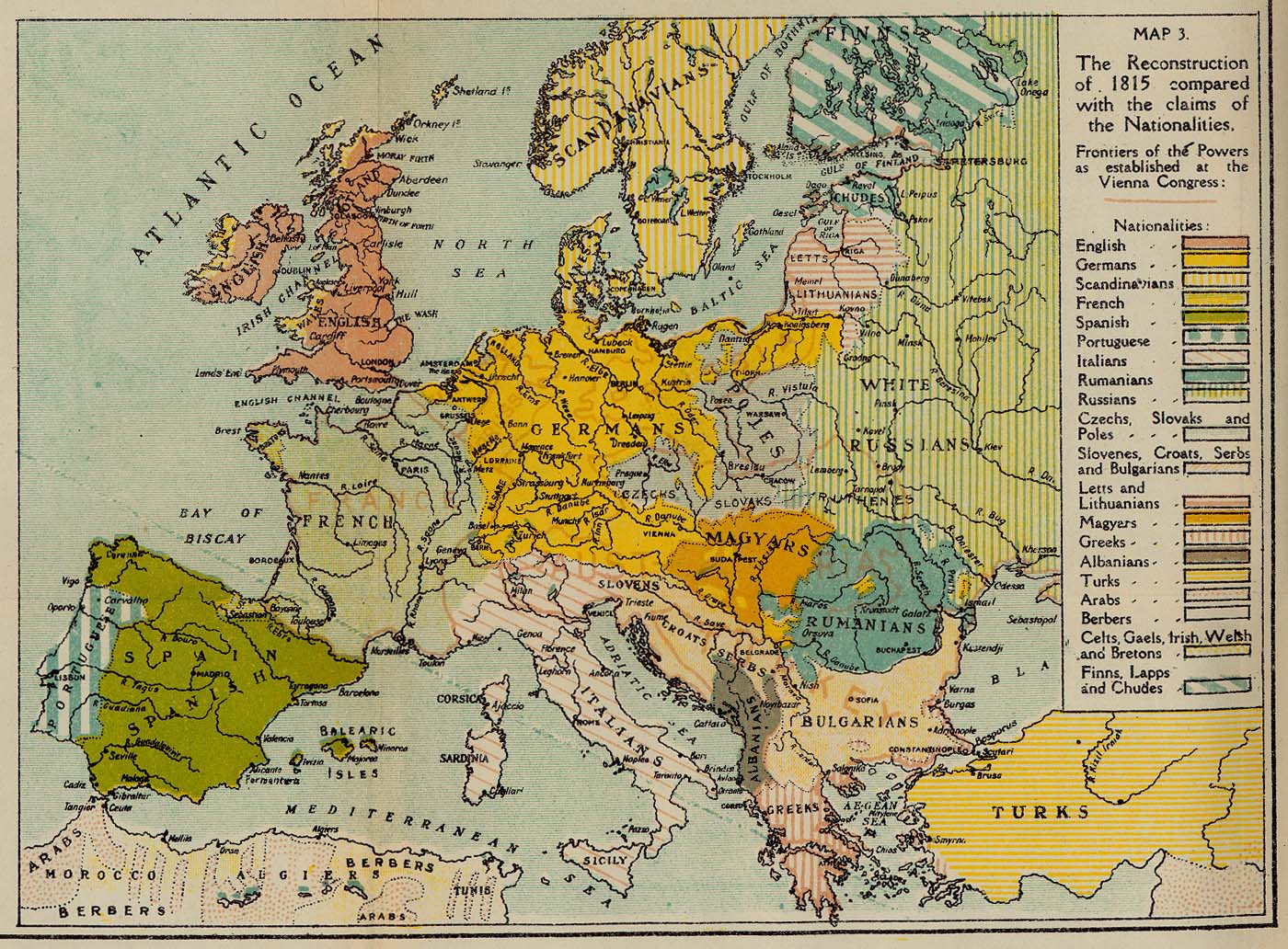
Reconstruction of Europe in 1815 Based on Ethnic Claims
The Reconstruction of 1815 Compared with the Claims of the Nationalities.
http://www.lib.utexas.edu/maps/historical/ british_dominions_yearbook/europe_ reconstruction_map3_1815.jpg |
Racial Map of Central and South Europe 1905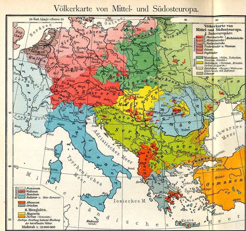
Racial Map of Central and South Europe. F. W. Putzgers Historischer Schul-Atlas, 1905
|
Racial Map of Europe
|
